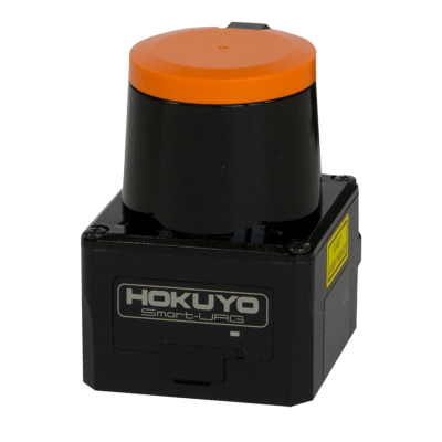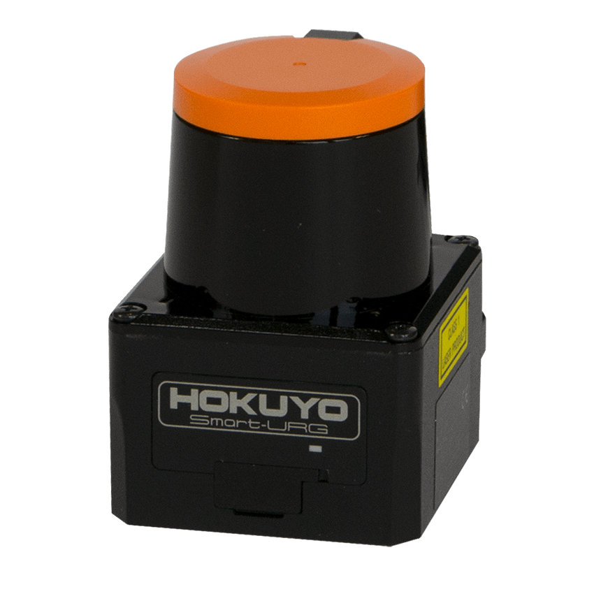
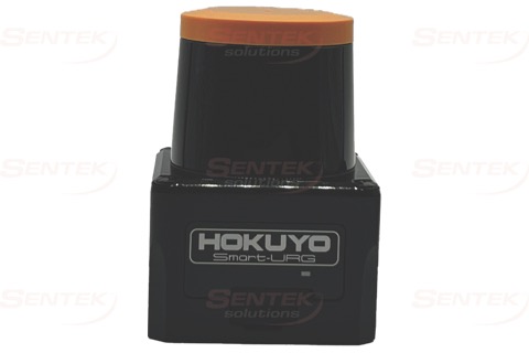
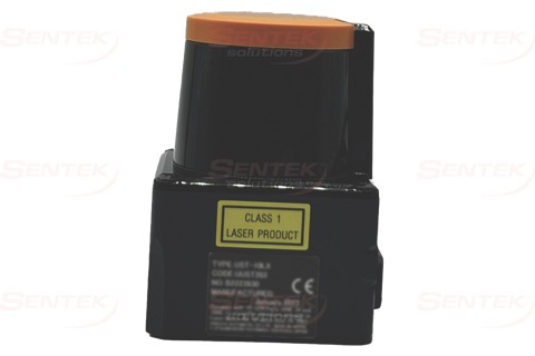
UST-10LX
£ 1,148.37
10m range, Ethernet connection, 270° field of view, 0.25° angular resolution.
Overview
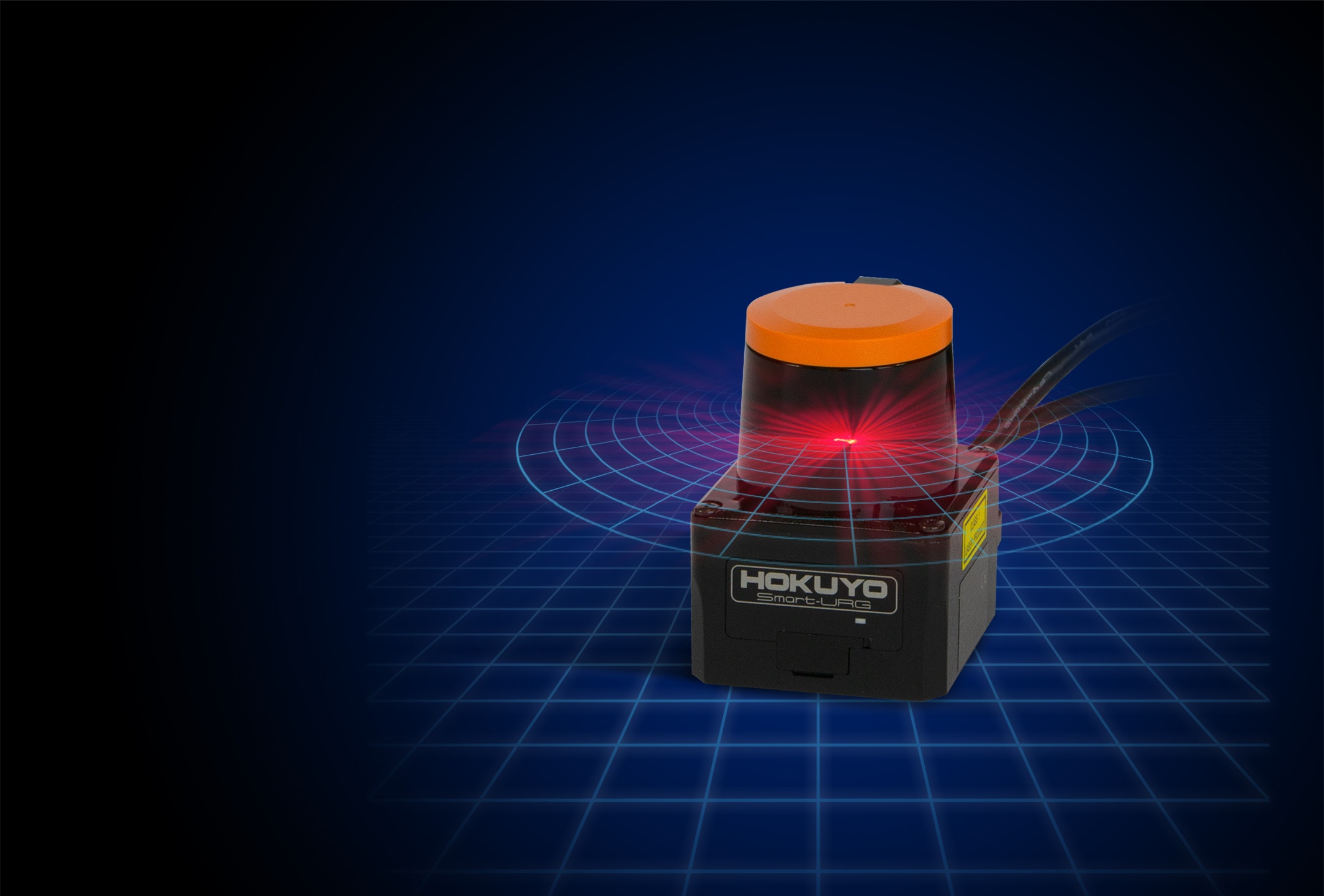
A high performance compact LiDAR with 10m distance measurement range, 0.25º angular resolution and Ethernet connection.
Common Applications
SLAM
Geomapping
Interactive Display
Operation Benefits
Indoor/ Outdoor – Indoor
Range – 10m
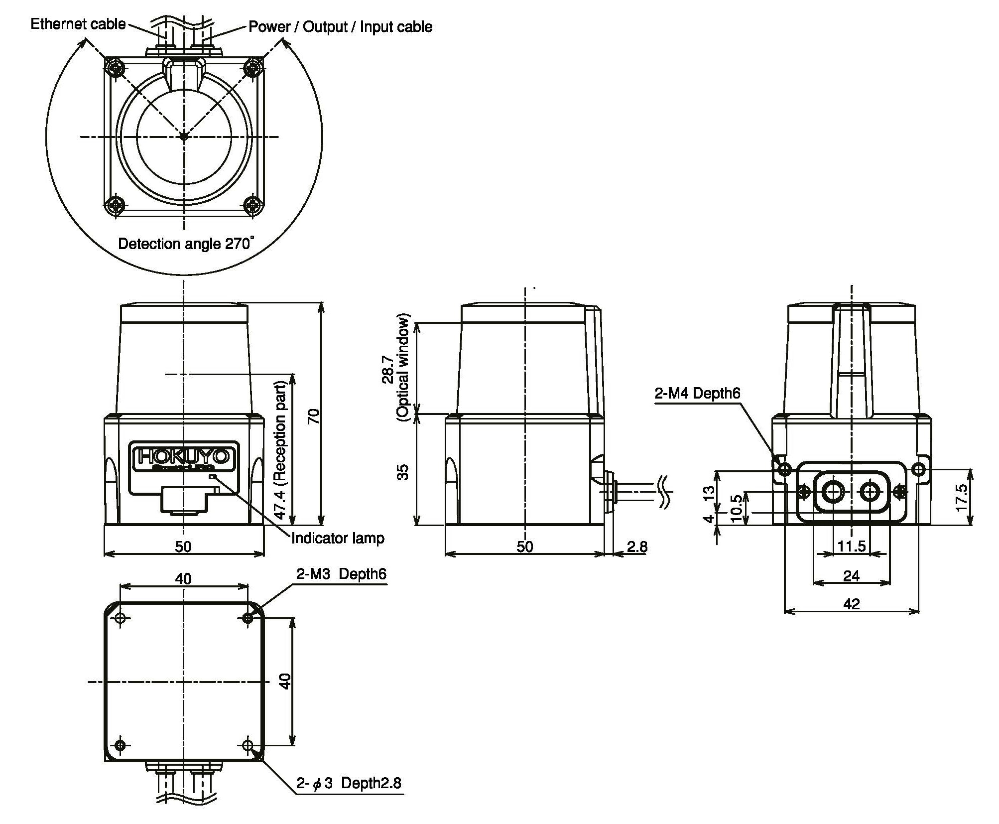
Scan window/ angle – 270°
Communication – Ethernet 100BASE-TX
Dimensions (l x w x h) – 50mm x 50mm x 70mm
Weight – 130g
Technical Information
Technology – Time of Flight LiDAR
Range – 10m
Field of View – 270º
Product Details
With it’s compact size and 0.25º scan resolution within a lightweight housing, it is easy to see why the UST-10LX from Hokuyo is a popular model. With distance and intensity data provided via Ethernet, this information can be processed quickly and applied to a wide variety of applications from Autonomous Mobile Robots through to interactive touch screen displays.
- Range - 10m
- Field of View - 270°
- Resolution - 0.25°
- Scan Speed - 40Hz (25ms)
- Multi Echo - No
- Type (2D/3D/RADAR) - 2D
- Supply current - 150mA or less (during start up 450mA is necessary)
- Output - Synchronous Pulse Output, photo coupler open collector output 30VDC 50mA Max Normally on
- Input - IP reset input, photo-coupler input (current 4mA at ON)
- Weight - Approx. 130g (excluding cable)
- Accuracy - ±40mm
- Operating Temperature Range - 10ºC to 50ºC Less than 85% RH (Without dew, frost )
- Detection range - 0.06m to 10m (White Kent Sheet) Max.30m
- Detection range at 10% reflectivity - 0.06m to 4m (diffuse reflectance 10%)
- Repeated accuracy - Standard Deviation σ < 30mm
- IP Rating - IP65
- Connections - Power source, I/O cable: 1m flying lead
- Light source - Laser semiconductor (905nm); Laser class 1 IEC60825-1:2007)
- Supply voltage - 12VDC / 24VDC (Operation range 10 to 30V ripple within 10%)
Resources & Information
Additional information
Additional information
| Manufacturer | Hokuyo |
|---|