Under the Canopy: The growing role of LiDAR in Forestry
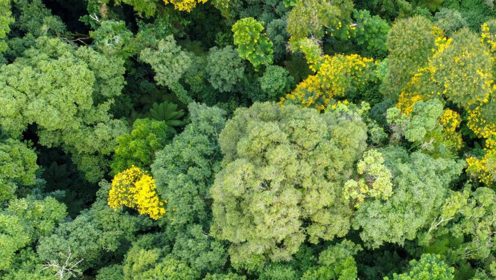
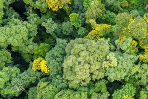
Forestry, a cornerstone of environmental sustainability, conservation, and resource management, is evolving rapidly with the advent of advanced technologies. Among these, Light Detection and Ranging (LiDAR) stands out as a transformative tool, reshaping how we understand, manage, and protect our forests.
This technology, which uses laser pulses to measure distances and create detailed 3D maps, offers unprecedented insights into forest structure, health, and biodiversity.
Here we look at the different ways in which LiDAR can impact Forest management.
1. Precision Mapping and Inventory
LiDAR technology allows for the creation of highly accurate and detailed maps of forested areas. Traditional methods of forest inventory, which often involve labour-intensive ground surveys, can be time-consuming and prone to human error.
LiDAR surveying, on the other hand, provides precise measurements of tree heights, canopy cover, and forest density across large areas with reduced time and effort.
This precision mapping is essential for effective forest management, allowing for better planning, resource allocation, and growth monitoring.
2. Forest Health Monitoring
Understanding forest health is critical for maintaining ecosystems and combating issues such as disease, pest infestations, and climate change impact.
LiDAR can detect changes in forest structure and biomass that indicate health problems. By analysing the vertical structure of the canopy and identifying gaps or unusual growth patterns, foresters can pinpoint areas of concern. This early detection enables timely intervention, potentially saving large areas of forest from degradation.
3. Carbon Sequestration Analysis
Forests play a key role in carbon sequestration, a process vital for mitigating climate change. Accurate measurement of biomass and carbon storage in forests is necessary to understand their role in the global carbon cycle.
LiDAR can provide high-resolution data that helps in estimating the amount of carbon stored in forested areas more accurately than traditional methods. This data can then be used for carbon trading schemes, climate modelling, and setting conservation priorities.
4. Habitat and Biodiversity Assessment
The structural complexity of forests, including tree heights, canopy layers, and ground vegetation, is a key factor in habitat diversity.
LiDAR’s ability to capture detailed data of the forest structure allows ecologists to assess habitat suitability for various species. This information is crucial for biodiversity, as it helps identify critical habitats, migration corridors, and potential impacts of habitat fragmentation.
5. Disaster Management and Recovery
Natural disasters such as wildfires, storms, and landslides can have devastating effects on forests. LiDAR can play a significant role in both pre- and post-disaster scenarios.
Pre-disaster, LiDAR data can help in creating detailed risk maps, identifying vulnerable areas, and planning mitigation strategies. Post-disaster, it can assess the extent of damage, aiding in recovery efforts by providing accurate information on areas that need restoration and reforestation.
6. Enhancing Silviculture Practices
Silviculture, the practice of controlling the establishment, growth, composition, and quality of forests, benefits immensely from LiDAR technology.
By providing detailed insights into tree growth patterns and forest structure, LiDAR helps in making informed decisions about thinning, pruning, and harvesting. This data facilitates sustainable forest management, maximising yield while maintaining ecological balance.
7. Supporting Research and Education
LiDAR’s detailed and accurate data is a valuable resource for scientific research and educational purposes. It can provide information for studies on forest dynamics, ecology, and climate change.
Educational institutions can use LiDAR data to train the next generation of foresters and conservationists, equipping them with the skills needed to tackle future challenges in forestry.
Conclusion
The integration of LiDAR technology into forestry is a game-changer, providing high-resolution, accurate, and comprehensive data that can transform how forests are managed and conserved. From precision mapping and forest health monitoring to enhancing silviculture practices and supporting research, LiDAR’s applications are vast and impactful.
As we continue to face global challenges such as climate change and biodiversity loss, LiDAR offers a powerful tool to support sustainable forestry practices and environmental stewardship.
We have several LiDAR sensors that can be used across a wide range of industries. You can find out more about our full selection of LiDAR scanners here. And make sure to stay up to date with all our news, insights and product developments by following us on LinkedIn and X.